Video
Watch video content
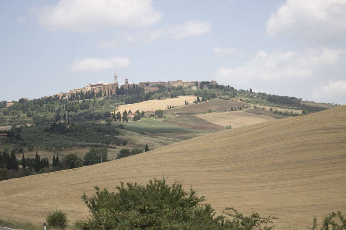
Pienza is unique for the exceptional nature of its architecture and for its landscape, the Val d’Orcia, which hosts it (World Heritage since 1996 the first, and since 2004 the second). Before Enea Silvio Bartolomeo Piccolomini, elected to the papal throne in 1458 as Pius II, decided to transform Corsignano, his hometown, into the summer residence of his court, the town was one of the many early medieval settlements in central Tuscany.
The Pope's ambitious project was carried out very quickly between 1459 and 1464 under the guidance of the Florentine sculptor and architect Bernardo Gambarelli (called Rossellino), who applied the Renaissance town-planning concepts learnt by his mentor, Leon Battista Alberti, a humanist thinker and architect. During the 3D Past Project, two survey campaigns were addressed to document the traditional architecture of Pienza. To describe the evolution of urban morphology, types and construction techniques, a serious game aimed at younger people was designed.
Pienza 3D Model
Explore interactive 3D models
Learn more about Pienza, Italy
The territory of the Val d’Orcia has always been populated, and in particular the ridges and the watersheds determined a network of roads and small settlements of huts inhabited since Neolithic times. A settlement, consisting of round huts, occupied the promontory on which Pienza sits.
The Etruscans, who settled in the area starting from the 7th century BC, transformed the landscape through reclamation and canalization works for the excess water of the valleys and slopes of the hills. They introduced the cultivation of grapes and created a network of settlements throughout the Val d’Orcia.
The primitive inhabited nucleus of Pienza dates back to this period, yet it is only during the Roman era that the settlement, known as Corsinianum, possibly derived from the name of the settler to whom the lands of this small promontory were assigned, was configured following the characteristic iso-oriented orthogonal mesh (centuriatio or castramentatio), in accordance with the agricultural division of the territory.
The Roman occupation of the territory marks the first traces on the Pienza hill that have remained visible so far. The east-west orientation of the current main street (today known as corso Rossellino) would in fact correspond to the ancient decumanus, while the via Marconi follows the original line of the cardo.
In the Roman period, the main building typology was the domus, an open enclosure space, with the house, generally one floor, usually located at the bottom of the courtyard. Following the fall of the Roman empire, cities were repeatedly attacked by barbarians and many inhabitants took refuge in the countryside. The fall of the Roman Empire led to the further population of the urban area. The courtyards of the domus, in order to accommodate new inhabitants in single-family dwellings, underwent a process known as insulizzazione.
In the Medieval period, the fabric of the first Roman town was flanked to the west by a second building fabric facing in a different direction, doubling the built area. The original city wall had to roughly follow its current circuit as far as the square, including its stronghold. At the beginning of the 14th century, Corsignano had 350 houses and 1750 people; most of the inhabitants were farmers, some were craftsmen.
Between the 12th and 15th centuries, Corsignano became a municipality and took on a precise configuration: the new constructions connected the most ancient nucleus to the fortress to the east, the church of Santa Maria and Palazzo Priori were built. Toward the mid-13th century, the Friars Minor of St. Francis built a monastery with a cloister.
In the mid-15th century, the Medieval settlement was almost completely restructured following Renaissance ideals. The architectural ideas of Leon Battista Alberti were widely applied through the masterful work of his closest collaborator, Bernardo Gambarelli.
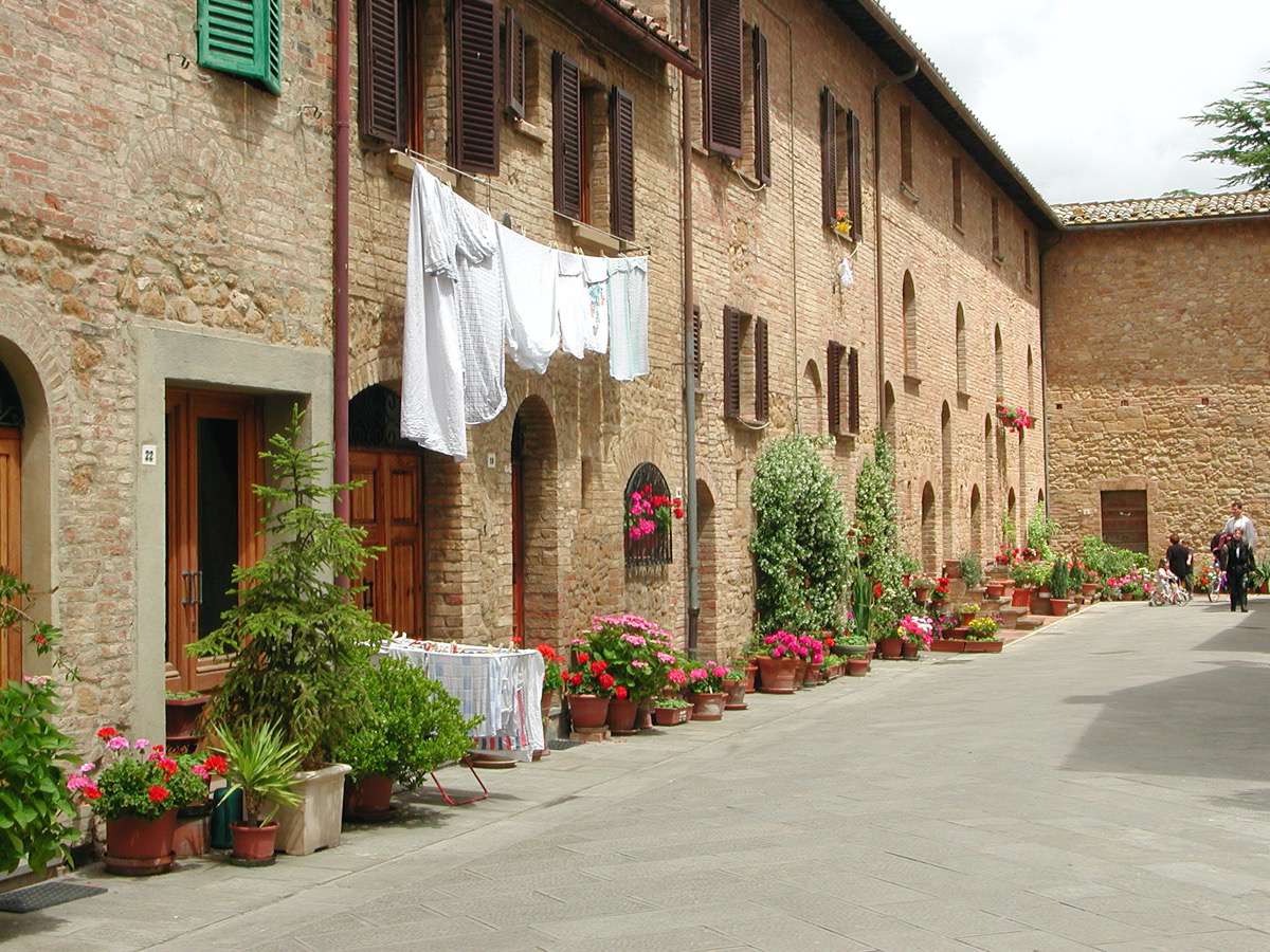
Following the expropriation of the dwellings for the construction of the square, the Pope had twelve new houses (Case Nuove) built for the poorer inhabitants. This set of row houses were once again built according to Pienza’s traditional typology, with a masonry structure in exposed bricks, two cells in depth on two storeys for each building unit, a transversal staircase with some steps on the exterior, as typological remain from the stairs placed on the side of the building, known as profferli.
In the new layout of the territory of Siena after the fall of the Republic (1555), Pienza lost its leading role as an administrative and commercial centre for the vast agricultural territory that surrounds it, falling back to its secondary role as a rural and agricultural town. This function undoubtedly permitted the work of Pope Pius II to maintain its authenticity throughout the centuries.
From 2004, the Val d’Orcia landscape, including the councils of Pienza, Castiglione d’Orcia, Montalcino, Radicofani and San Quirico d’Orcia, was listed as a UNESCO World Heritage Site. It is a unique and architecturally invaluable instance of different landscape forms, in particular the two opposite slopes of the Orcia: the southern slope, characterized by the cone of Mount Amiata, and the northern slope by the skyline of hill ridges, on which Pienza stands. It presents traits of complexity and variety due to its particular geological structure, in which predominate igneous rocks from the region’s volcanos, Amiata and Radicofani, as well as clayey and sandy sediments. This combination underlies two phenomena: on the one hand, the abundance of water sources and hot water springs, around which the habitat has developed since pre-Roman times; on the other hand, the constant transformations of the landscape, due to the fragility of the clay hills and their tendency to open into ravines and gulches in times of drought. This last feature has determined the anthropic construction of the current landscape through water canalization works and excavations on the slopes, whose functional efficiency is still evident today.
The Val d’Orcia territory exemplifies the beauty of well-managed Renaissance agricultural landscapes. The exceptional cultural landscape includes agrarian and pastoral management systems, towns and villages, farmhouses, the Roman Frankish Route (Via Francigena), and its associated abbeys, inns, shrines and bridges.
Geographically, Pienza is located in a strategic territorial node, at the intersection of two important route axes: the Via Cassia (North/South), roughly halfway between Rome and Florence and the road perpendicular to it, which leading from the ports of the Maremma up the Ombrone river to Val d’Orcia passes south of Pienza, before crossing the pre-Apennine ridge at the source, to reach Chiusi and Val di Chiana.
Val d’Orcia is a perfect example of an area with a rural vocation. Prior to Pienza there had never been a city inside its territory, which means it had to pay tribute to two adjacent towns: Chiusi to the east, during the Etruscan era, and Siena to the north-west, during the Middle Ages.
Hence, the widespread share-cropping in Val d’Orcia: peasants were not landowners, but halved products (consequently the word the word 'share-cropper') with the landowner or with the town authorities (in Val d’Orcia the Abbey of San Salvatore sull’Amiata or the Hospital of Santa Maria della Scala di Siena), who owned most estates.
The derivation of estates from the Roman country-house is exemplified by the characteristic closed-courtyard form of its dwellings and farmhouses, whose typical forming process can easily be hypothesized: their residential wings were originally placed in front of the entrance doors facing the sun; at a later stage, adjoining rooms progressively formed around the 'threshing floor' (pertinent area) protected by its boundary wall, which is still the estate’s main building constituent.
Historical settlements in the Val d’Orcia, although rare and small in size, are greatly important for the configuration of the territory, and occupy the main hubs or strategic locations, adhering sensibly to the natural morphology.
When arriving from the countryside and looking upwards, it was possible to perceive their shape, rhythmed by towers and gates. This still partially applies to Pienza, whose defensive structures were strengthened around the year 1550 with the consolidation of the walls, and the construction of a fort in front of Porta al Prato. Its characteristic southern hill-skyline stands out among the rolling hills of Val d’Orcia, attracting the attention of travellers along the Cassian way en-route from Rome.
However, where the slope is slighter, its walls were demolished or lowered to allow for urban sprawl beyond its ring road, which began in the 1950s.
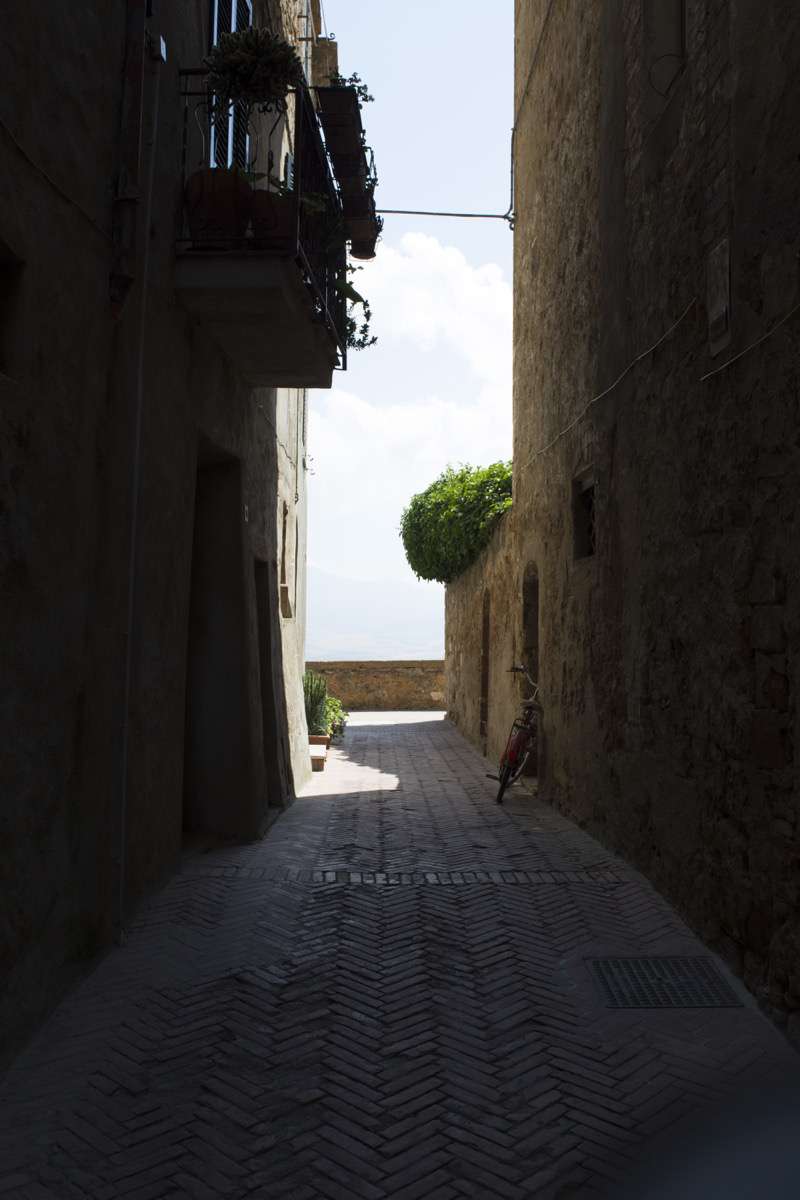
The urban structure of Pienza is typical of the late Medieval village erected on the head of a ridge, and therefore, easily defensible, in order to control the valley below: its two main gates (al Murello and al Ciglio) are connected by its main street, which roughly follows its promontory ridge and is crossed by its alleys, the 'ribs' of its building-fabric. At one end, the main street asymmetrically divides the settlement, which, on its shorter southern slope, stops short at the cliff’s 'brow'. Centrally placed, a side street connected two secondary gates (one of which no longer exists), intersecting the main street, where it markedly changed direction. Two squares span this junction: its market square and its civic/religious forum with its town hall and its cathedral. Pienza was thus subdivided into four quarters or districts, whose formation in time is one of the trickiest, most interesting aspects of its history.
Residential construction is the fundamental 'basic' component of the urban scene. The elementary cells have an average net span of 6x6m, but there are also some 7-8x4-5m rectangular shape cells.
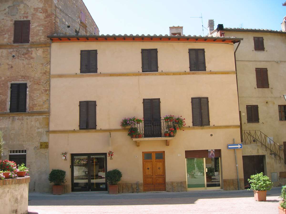
The basic typology was the house with one or two overlapping cells; the upper space was accessed through an external staircase extended on the front, called the profferlo. The semi-basement level was used as a cellar and for storing firewood. Today, most of the profferli have been demolished or enclosed in the interior of the dwelling unit, through the partial or total demolition of the facade of the building, and the construction of a new external wall.
The various methods of expansion of the covered dwelling area, according to the progressive 'doubling', both in height and in depth, have determined the so-called 'typological process': from the 'matrix' type of elementary cells to the single-family row house or terrace-house type, up to the recent multi-family in-line house type (present sporadically in Pienza and only for the 'recast' of terraced houses).
Single-cell homes, especially during the 19th century, expanded in height with the addition of a third floor, or merged together giving rise to online associations, to one or two apartments per floor. The stairs that connect the floors together are generally located in a central position.
Although today the survey of the number of floors shows that most of the buildings consists of three floors above ground, probably the same houses originally did not exceed two floors.
Residential construction is the fundamental 'basic' component of the urban scene. The elementary cells have an average net span of 6x6m, but there are also some 7-8x4-5m rectangular shape cells.
The basic typology was the house with one or two overlapping cells; the upper space was accessed through an external staircase extended on the front, called the profferlo. The semi-basement level was used as a cellar and for storing firewood. Today, most of the profferli have been demolished or enclosed in the interior of the dwelling unit, through the partial or total demolition of the facade of the building, and the construction of a new external wall.
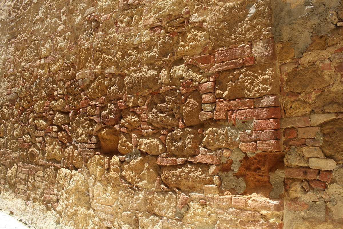
The materials used in historical masonry structures are bricks and local stone, mainly of two types: a siliceous sandstone, rather compact and yellow-redish in colour, and a very compact whitish, pale-yellow or grayish-yellow calcareous stone, known as 'tuff '(or 'tuff rock').
These materials are either used on their own or in combination with the other in variable percentages.
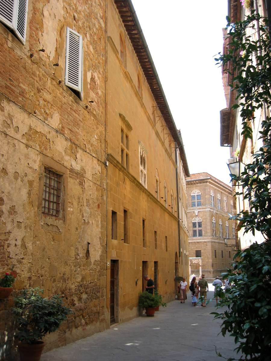
Mixed masonry is predominant; heterogeneous materials coexist in it in terms of both type and size (rough stone elements, whole or chipped bricks, pebbles, and re-used materials). These various elements are placed in recurring rows or without a predetermined rule. The thickness varies between 60 and 90 cm, progressively diminishing in the direction of the upper stories. On the ground floor the section of the walls is almost trapezoidal. Masonry with a more heterogeneous and composite nature is covered with plaster so as to provide it with a certain apparent uniformity. Masonry with hewn stone, made with larger blocks, was used in more representative buildings, especially in the most vulnerable parts of the building, such as corners, doors and windows.
Brick masonry was infrequently used, and is present mostly in the case of upper storeys, in the cladding around doors and windows, and in substitution of damaged elements.
The most commonly used binding element is a lime and sand mortar, which offers both resistance and durability. Both the lime and the bricks were produced in kilns located near the city.
Floors have a load-bearing structure in timber beams (known as travi maestre, 18-23 cm x 20-26 cm, with a length corrisponding to the cell they cover, generally 6-8m, and a 160-190 cm centre to centre distance), on which a system of joists (6-10cm x 8-10cm with a 35-37cm centre to centre distance) is orthogonally placed. The beams enter the wall into approximately half of its thickness. The joists support hollow brick tiles (35x70cm). Floors, on the ground level, are usually structured perpendicularly to the street front. This structure is, in some cases, maintained on the upper storey, while in others it is rotated 90 degrees, thus ensuring a better connection to the surrounding walls.
Also the structure of the roofs, either single or double-pitched, and with an average inclination of 30%, has a double frame, with beams, joists and brick tiles (35x70 cm).
The rooms in the basement are covered by barrel or groin vaults. The use of brick arches is limited to the doors and windows: windows use diminished arches, whereas those of doors can be either round or diminished; bricks are laid ledge on (with the greater side perpendicular to the generatrix, and the middle side placed to form the thickness).
The sizes of openings are generally homogeneous: windows are 80-90 cm x 150 cm, whereas doors are 100-105-90 cm x 210 cm.
The historic centre of Pienza has maintained its authenticity in terms of urban layout and of building techniques and materials. It is still possible to identify the Medieval urban structure, as well as the interventions from the Renaissance era. The whole town presents today a technological homogeneity, since the building techniques have remained almost unchanged throughout the centuries, also thanks to the absence of destructive events (such as earthquakes), and the care of the inhabitants in maintaining their houses.
Most of the buildings are in good condition. There are only few structures with relevant signs of deterioration (collapsed sections, fissures with infiltrations, obvious bulging, etc.). The decay involves mostly wall materials, especially bricks, mortars and plasters. Bricks are often eroded or chipped, mortars pulverized and plasters partially or entirely detached. To the damages caused by the passage of time, those resulting from inadequate maintenance and restoration interventions can be added. Wall surfaces often present modifications or plugging of holes, substitution of original materials, the adding of flues and technological installations, which can be identified on the exterior by the traces of cement on the walls. Added storeys are also frequent, especially dating from the 19th century.
The surrounding agricultural landscape has not undergone any industrial or infrastructural developments altering its architectural or urban features.
The historic centre of Pienza and its surrounding territory are protected, which means that any intervention carried out in the town must be approved by the entities in charge of its safeguarding. The territory of Pienza, furthermore, has been, since 1989, a part of the Artistic, Natural and Cultural Park of the Val d’Orcia. The Management Plan for the Park of the Val d’Orcia aims at the safeguarding and valorisation of the territory in all its cultural, historical and natural aspects. Its priority objectives are the preservation of the cultural landscape and of local traditions, within the framework of a sustainable development strategy.
The current management systems have proven to be sufficiently effective for the safeguarding of the site, yet an action in collaboration with the local socio-economic entities and stakeholders is necessary for the sustainable management and valorisation of the resources of the territory.
The most alarming threat today is related to mass tourism, which has brought about an increase in real estate value, and a tourism-related commercial specialisation of the historic centre. The constant presence of tourists has progressively changed the identity of the stable population, as well as the decrease in the sense of belonging of the inhabitants of the historic centre. Artisan activities have almost entirely disappeared to make place for tourist-oriented commerce, concentrated along the main street. This presents the risk of authenticity loss, vulgarisation of the local products, and a reduction of the offer of ordinary goods available to residents.
This is extremely risky in terms of the safeguarding of the values of the historic centre, since it is transforming Pienza into a 'museum-city', with a consequent decrease in the number of original residents, and a social gentrification of the centre itself.
The preservation and maintenance of the existing historical heritage should be agreed upon by the various stakeholders, thus strengthening the dialogue with the inhabitants and the associations that organize the activities and the management of the structures, through the creation of a network of relationships between institutions and community, from the perspective of an active participation in the reconstruction of a 'lifestyle', which has made this territory unique.
In order to produce 3D polygonal models with a great degree of realism to be used in walkthrough (virtual strolls) platforms, it was necessary to undertake a survey campaign that used both active sensors (laser scanners) and passive sensor (digital reflex cameras). The former permitted obtaining a precise and verifiable morphometric documentation of the registered scene (range based models), whereas the latter allowed the production of polygonal models that included chromatic data (image based models).
The area analysed is located on via Gozzante, in proximity of Porta al Murello, one of the main gateways to the city.
The necessary workflow for obtaining photogrammetry models (Structure From Motion) is well-known and consolidated. 1207 photographs were taken for the case study, which covered the full area of the survey (approximately 60 linear metres). The photographic sets were produced with a Sony Alpha 7rII camera, with a 42.4 megapixel full-frame backlighted sensor, and a Sony 16-35 mm F4.0 lens (Zeiss series), and saved in native ARW format (Sony Alpha Raw).
As in most 3D models developed through digital photogrammetry process, they were re-worked and treated, so as to correct any errors concerning the topology of the surfaces or the excessive density of the polygons. In the case of the latter, in fact, the high number of sides generated by the photogrammetry software does not adequately suit the real-time management and visualisation needs of the models in question, thus making it necessary to control their decimation to ensure the correct balance between the realism of the shapes and the density of the mesh.
The photogram in the image shows the result of the operation: the virtual visitor can move freely along a street in Pienza, admiring the quality and details of the architecture.
The sky, the background and the ambient lighting were automatically obtained from a HDRI (High Dynamic Range Imaging) map, created for that purpose on the day of the survey campaign.
Unlike spherical panoramas, which are developed with the use of static images taken from a single position and then projected onto a spherical or cubic surface, 3D models permit browsing the model in all of its parts, without being committed to any predetermined point of view.
