Video
Watch video content
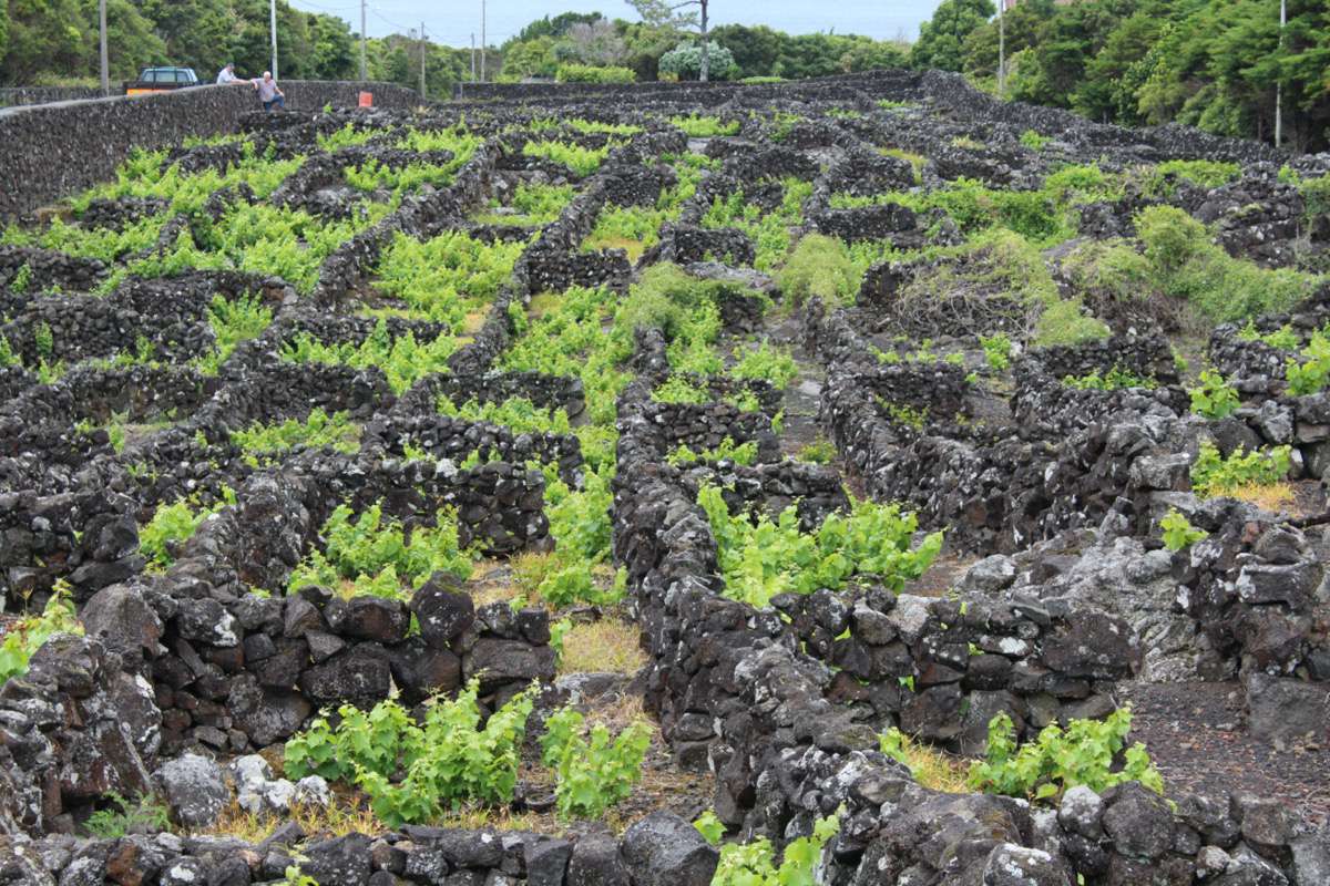
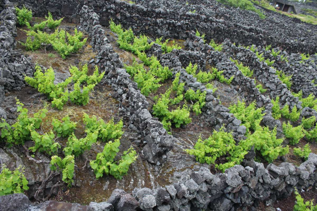
Composed by two different areas, the World Heritage site of Pico Island constitutes a hybrid landscape that articulates the harsh volcanic soils of the North coastal areas and the wine production fields. The wine fields are characterized by the geometric patterns composed by the ‘currais’, elements of great landscape impact, due to their contrast with the surrounding wild vegetation. The ‘curral’ is a small walled area, configured by volcanic dry masonry, destined to protect the wine plants from the aggressive sea wind. The patterns are structured by long longitudinal walls, which cross the topography, intersected by small perpendicular walls, configuring a set of similar enclosures. These enclosures are subtracted from the thick lava layer areas that covered the soil, providing also the material for the walls construction.
Little Wine Cellar 360° Courtyard View
Explore interactive 3D models
Learn more about Pico, Portugal
By the time of its discovery, Pico Island was covered with rich forests and had proper land for agriculture practice. Both resources were crucial in the 15th century, at the beginning of the population of the archipelago, when the Azorean economy was built on commercial trading with the mainland, and the main products exchanged were cereals, pastel, cattle and leather. With the growing occupation of Pico, and the island inherent deforestation, these conditions gradually disappeared.
The production of wine, probably dating from the beginning of the island’s occupation, increased in economic importance at the same rate that the conditions for agriculture practice disappeared.
Pico has a slightly warmer and drier climate than the other Azorean islands, so it was an appropriate island for vine cultivation. Those plots were the only source of economic income, on the West part of the island; a landscape of small man-made open plots that were built with volcanic stones.
Monterey (1979) mentions that the first priest on the island, Frei Pedro Gigante, was responsible for importing the Verdelho strain from Madeira Island, and for cultivating it in Pico island. Other authors argue that it did not come from Madeira, but from Cyprus or perhaps Rome.
Along the 16th century, wine production was already an important source of income, but was intended entirely for local use. Over the following centuries, its production intensified with great strength and the economic importance of its production grew with its exportation to several countries, such as England, the North American English colonies, Brazil, but also Russia, where, after the 1917 revolution, some bottles were found in the Czar’s cellars. Its importance was such that, as highlighted by Duarte (1995), the territory was organized according to the convenience of the wine production, transportation and storage.
But this important development came to a sudden ending in the 19th century, when a phylloxera plague destroyed most of the vineyards. This disaster induced the grafting of a new variety of grape, resistant to phylloxera. The solution did not solve the problem and probably was the cause of other plagues that attacked the vineyards over that century, such as fungus. This massive de struction ruined the wine economy of the island and led to the abandonment of the Verdelho production, and the introduction of the Isabella, a variety of grape imported from America. But the new wine did not have the same quality, so the economic importance of the wine production was never fully recovered.
The island lack of resources and the wine-centre approach was decisive in the formation of the handmade landscape and culture of the place. Settlers forced to survive where there were no resources, were responsible for the construction of Pico’s traditional architecture, always associated with the culture of wine. In the 19th century, the vineyard plague forced islanders to search for another way of survival. Whaling, a tradition that was inherited from New England, become, for a certain period, one of the most relevant activities in the island.
The interaction between natural challenging conditions and a built environment created with great difficulty produced a distinctive cultural landscape, with a unique legacy of Outstanding Universal Value. These characteristics favoured the implementation of technical building solutions that reveal great ingenuity and long-term commitment, to ensure lasting results.
The buildings are assembled in small clusters and settlements presenting a fragmented configuration, dispersed along the peripheral road that follows the coastline. These small settlements are connected with each other. However, some of the settlements present an extensive area without any traditional structure between them. In other cases, their limits are overlapped, resulting in a continuous occupancy without ruptures.
The configuration of this ensembles does not present any specific shape or clear delimitation. The only observed tendency is the increase of density in the intersection between the coastal road and the perpendicular roads (canadas) that penetrate into the island centre. These perpendicular roads cross the vineyard slopes connecting the coast and the highest settlements, outside the wine area. In some cases, the canada adopts the settlement name, which reveals their structural importance in the territory organisation.
The wine settlements need to be interpreted as a seasonal expression of the community’s production activity. These communities live in villages located above the island lowlands, where the agriculture production is more intensive and diverse due to a better soil condition. With the increase of the wine and liquor production, these seasonal settlements gained a progressive importance. Despite their singularity, it is not possible to look at the World Heritage area without considering it a complement of the entire regional livelihood. The vineyards should be considered like a satellite entity of the small villages, connected between them through the canadas roads. According to Jorge and Valdemar (1998), this communication assumes a significant importance in the territory organisation, often influencing the building alignments, specifically in the densest occupation areas.
The distinction of the World Heritage property in two areas, according to the UNESCO classification, follows the spatial organisation related to vineyard management – distribution channels of the western part of the island and the neighbour islands. The southeast area corresponds to the maritime connection between Madalena village and the Faial island, namely to Horta city, the closest biggest settlement, where most of the Pico’s wealthiest landlords lived. The Northeast zone relates with the São Roque harbour and its connection to the São Jorge island. The Cabrito place, selected as a representative cluster, is considered a satellite entity of the Santa Luzia village, located in the Northwest coast of the island.
The Cabrito settlement is one of the less altered building cores, preserving a significant number of buildings with original elements. It is located in the oriental extreme of the North Coast of the World Heritage property. This settlement is at the end of the vineyard culture, at the topographical transition that precedes the region of São Roque do Pico. From this settlement, there is no paved road and the old coastal access is suggested by sections that simultaneously resist maritime erosion, but also cadastral alteration, with increasingly larger and more irregularly shaped plots. Cabrito settlement expresses well the actual planning pressures between the introduction of current residential programmes, focused on summer occupancy, and the preservation of the traditional systems, with hard to find man labour work.
Most of the buildings are located near one of the communication roads of Pico’s World Heritage property, which is linked to an isolated plot of land. The road is on one of the sides of the plot, and the vineyards are on the other side. Usually, buildings are isolated, and their main façade faces the sea, not always corresponding with the main access to the plot. Within each core, a greater affinity can be observed between small sized sets, never exceeding 3 or 4 building units. Cabrito settlement clearly presents some sets of this kind. However, it reveals a disturbing evolution, as many of the sets are in an advanced state of degradation or in a process of adulteration due to the addition of elements without typological reference. Currently, new construction does not have a community preconception, or collective dynamics. It is more about isolated and individual interventions, breaking the logic relation gathered between groups of different units.
On the North coast, the ensembles rarely presented a closed configuration, as in general they were not limited. However, they were often segregated by flagstone areas, which irregularly delimitated the territory, separating the ‘stone walled plots’, also known as ‘walled vineyards’ (currais) from the sea.
The social centre of these cores was considered a typical public space, structuring the dynamic of the main community activities. These centres had, at least, one of the following traditional built components: a tide-well (Poço de maré); a small port (Portinho); and a Hermitage (Ermida). In most of the cases it forms a reasonable defined enclosure. There are transversal spams of about 30 meters, as there are places of passage during most of the year, with greater concentration of people during the harvest period, and the religious festivities, such as the Patron Saint and the Holy Spirit devotion.
These traditionally built components revealed the difficulties of people’s lives on the island. The tidewell featured the implementation of the old method to obtain fresh water, through the intersection of the underground water table in saltwater environments of the Atlantic Coast.
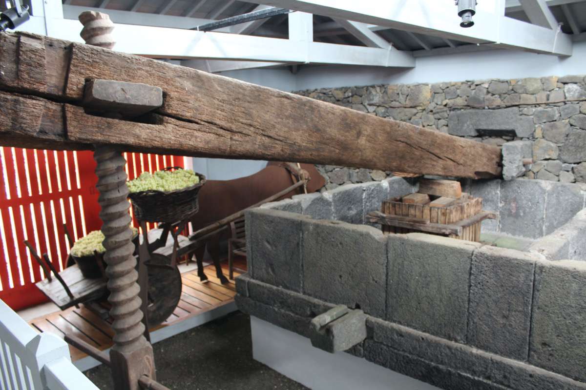
The wine barrel-roll (rola-pipas) reveals the marks of the wheels that were left on the rock, expressing well how difficult it was to transport wine barrels on volcanic ground. This rock marks helped slide the wine barrels and the fig liquor production to the boats. The production distribution was possible through canals sculpted on the coastal rocks, at the extension of the mentioned community spaces.
The worship components, specifically in Hermitage places, also constituted characteristic features of this type of settlement. Due to their symbolic importance, sometimes there were more exceptional features standing above the remaining buildings.
In the middle of the Atlantic Ocean is located the Azores archipelago, composed by nine volcanic islands. Pico Island was the seventh to be discovered by Portuguese sailors, during the 15th century. Its name is due to the pyramidal form of its mountain, a geological volcano reaching 2.351 meters, the highest mountain in Portuguese territory.
Pico Island has an amazing vineyard culture, especially in its western coastline. The exceptional landscape character granted to Pico a World Heritage status in 2004.
The hardness of the volcanic stone, the resources shortage and the archipelago unstable weather, relies on a communal perseverance to achieve tangible outcomes. The resulting landscape configures “an outstanding example of the adaptation of farming practices to a remote and challenging environment”, articulating the desolate nature of the lava coast with a man-made system created throughout five centuries of hard labour in very difficult climatic and environment conditions.
The success of this unlikely agrarian development produced an exclusive type of wine, known as verdelho wine. This is one of the most traditional casts that was, for a long time, the main economic activity of the island, and one of the most emblematic products of the Azores archipelago.
In the island, vineyards were planted in compact portions with protected walls presenting remarkable patterns. Even though these walls have a recognizable matrix, vineyards present an irregular character. Their singularity is related to the systematic aggregation of small and contiguous walled spaces that were built to better protect the vines against salt and maritime wind. Vines were planted for centuries and continue to be planted in very challenging conditions. The volcanic stone masonry that surrounds these small plots (known as currais in Portuguese) was composed by walls with rock extracted from the clean lava land that superficially covered the soil.
These were the areas that inhabitants classified as ‘biscuit ground’ (chão de biscoito) and ‘lajido ground’ (chão de lajido). In this way, raw material extraction and ground preparation consisted of the same task. Afterwards, the surplus of the material that was not used for the construction of the currais was piled in huge volumes (known as maroiços), resembling to rough pyramids, which constituted a unique landscape reference, along the wine production region.
In some locations of the World Heritage property, it is the case of the Santa Luzia place, the fig liquor production was as significant as the wine making. This activity resulted on a variation of the currais configuration. The partition wall facing the sea always presented a semi-circular configuration, in order to better adjust to the shape of the treetop. Traditionally, the fig harvest was accomplished in two phases: first, the fruit was anointed (untado) and then, 8 days after, it was harvested. This task defined the beginning of the coastal area seasonal occupation.
Most of the vernacular architecture of the World Heritage property directly supported the vineyard activity. The architecture configuration was related to the production, transformation and distribution of the wine and of the fruit liquor. The vernacular built elements complemented the logic of the farming areas. The stonewalls built to protect the wine and the figs plantation constituted the stone plots that were the main responsible for the overall visual impact, forming the traditional structural element of the territory organisation.
The little wine cellar, the wine cellar-house and the summerhouse with cellar are the dominant typologies of the vineyard landscape. These are evolutionary variants that reinforce the increase of the summer occupation beyond the harvest.
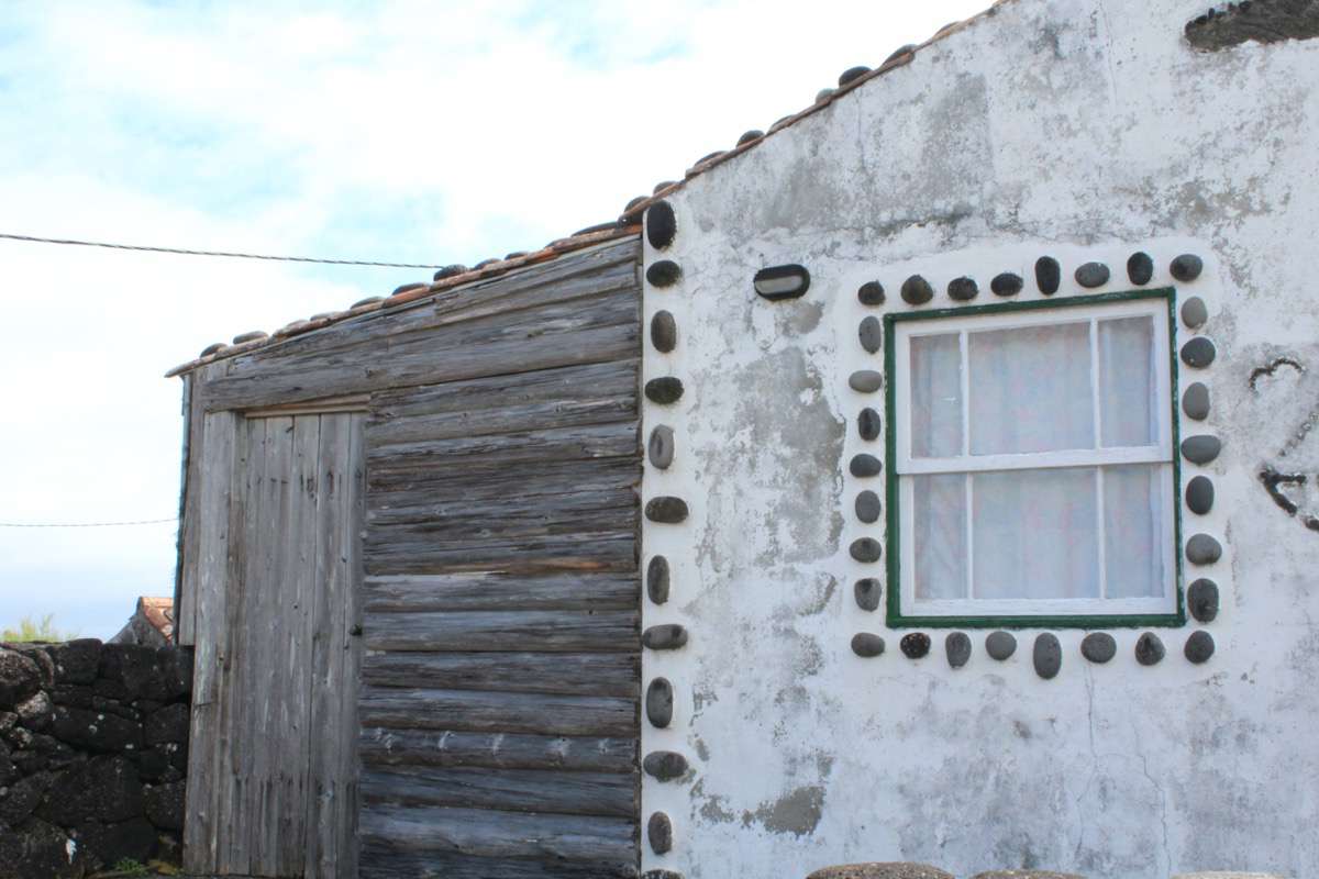
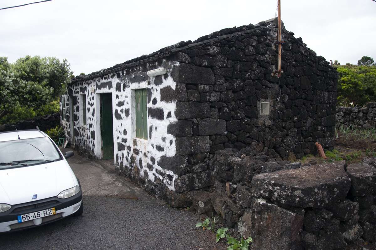
This typology constitutes the basic unit devoted to the storage of small quantities of barrels and bottles. These extremely small buildings are located in small properties of individual production, usually close to the main village. They present a rectangular regular shape, with a simple pitched roof, only one door and no windows.
They do not have any interior partition, and their functional complements are reduced to a single wooden shelf or bench. More than a production unit, these elements are related to family and friends’ gatherings, used as a place for outside meals in the summer.
It represents the horizontal extension of the cellar by the addition of the kitchen and the subdivision of the sleeping area. In all the observed cases, the kitchen and the rooms corresponded to transversal separated compartments. These spaces were created by detachable wooden partitions, segregating the new functions from the areas of wine and liquor processing. This development represents a significant importance of the wine production for the family income, and therefore a bigger investment in the size and quality of the construction. In most of the cases the building also accommodates the tank and press mechanism, which implies bigger dimensions.
It represents the vertical development of the original cellar, adding an upper floor to the original structure. In this case the residential function is completely segregated form the wine production, with no internal communication, allowing a more flexible use of the building from the harvest activity. It also represents a more elaborated construction technique, namely on the first floor, exclusively used as a house. The kitchen is the main space, serving also as the social gathering room; the bedrooms are segregated from the main internal volume through the placement of the previously stated wooden partitions.
The building’s foundations are usually inexistent, as buildings directly arise on volcanic ground. This is usually done through the direct levelling of the pavements. In most of the old wine cellars, especially in the most modest cases, the ground is simply covered by a volcanic gravel layer with fine granulometry, the characteristic lapilli (bagacina). This solution allows a pragmatic drainage of the spilled liquids (derived from the production), without any scoring system.
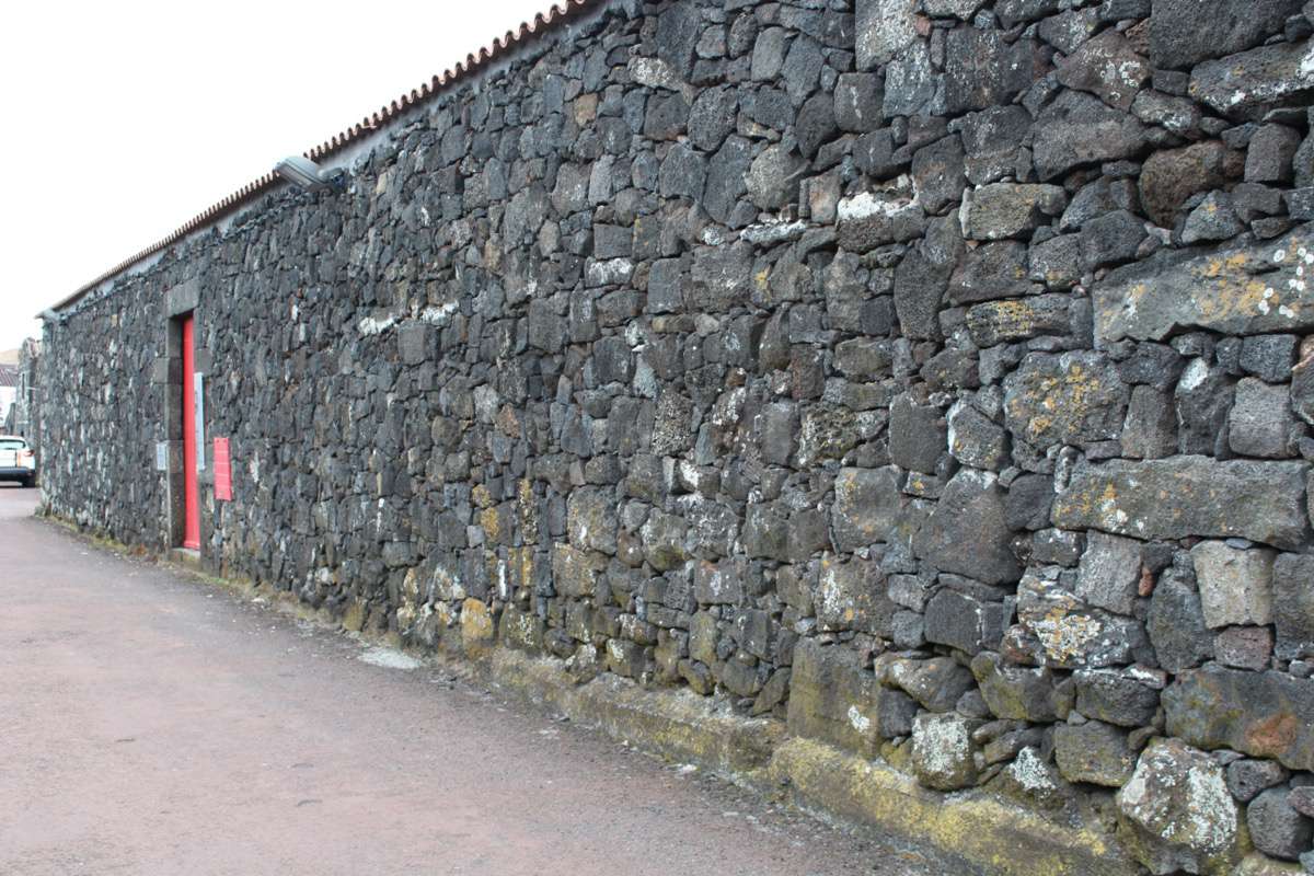
The external walls were built by multiple volcanic stone layers with a varied geological composition. They present considerable thickness, which reached a section around 50–60 cm. Openings are occasionally integrated with more bearing and regular lineal elements, provided with lintels supported by keystones – pillars. The support pieces present an indented alternation with the execution of a transversal locking, which covered all the internal surface of the opening.
The internal walls were constituted by simple wooden partitions (frontais). These non-structural elements were executed with vertical alternated planking (with a width of 20cm), generally in cryptomeria or Japanese cedar wood (Cryptomeria japonica). The wood was cut directly and had a superficial sanding, without any additional treatment. This kind of wood was particularly appreciated the Azores due to its durability and resistance, even without any protective treatment.
The wooden structure that supported the roof was extremely simple, generally composed of a truss ensemble, with a reduced spacing between each truss. These wooden elements presented a small circular section, joined by a simple fitting at the extremes of the beams, which had a wedge shape. The solutions generally present a ring-beam (frechal) to solve the contact with the external walls, and it usually did not include any ridge-beam (tábua da burra). Sometimes, the type of wood could change, and in the case of Cabrito settlement, it is possible to identify the use of incense wood and beech wood.
Traditional roofs were covered by one canal tiles, with the following features: a noticeable length, an upper flatten arch. Over time, ceramic tiles were gradually replaced with cement tiles with the same type of configuration. Besides the lack of clay as a raw material in Pico island, clay tiles had the advantage of a better resistance against erosion, caused by the sea salt. These tile elements were a handcrafted production, with little production in the island market. Nowadays, there are still some stored sets of clay tiles, which are insufficient to the current demand. This causes that many inhabitants replaced their roof tiles with an industrial tiles production of different configuration. Tiles are directly placed above a wooden planking, disposed over the wooden trusses. Wooden planking was overlaid on the top of the conventional board, minimizing the effects of the occasional filtrations.
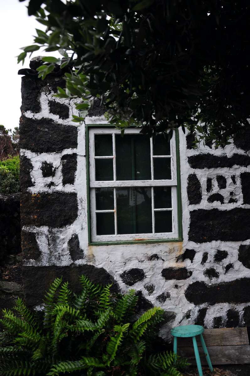
There were three types of openings: doors, cellar gates and windows. One very characteristic detail was the red colour paint applied in the wood of the openings. Usually, the applied colours were green, red and apricot. These exceptional elements stand out due to the contrast with the predominant basaltic black colour presented in the building walls, as well as in the island landscape.
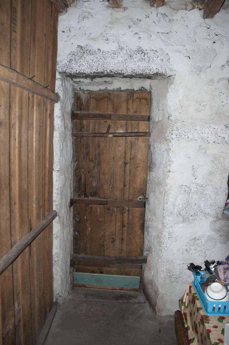
Windows were generally built as chest windows and had small dimensions. In most simple cases, they had board doors provided of quadrangular openings in each sheet. In the studied region, there was still the solution based on a glazed guillotine system. Glass in the windows had a quadrangular configuration with different compositions, but the most common was 4 or 6 identical fragments per sheet. Doors were high or low with one open sheet, and were generally aligned with the chest-window (janela de peito). The doors were generally distinguished by the domestic entrance and the work entrance. Their particularities gave a chance to verify the evolution from the unit-base to the work space. Doors were made of vertical boards, directly attached to two or three horizontal beams, which were fixed to the rotation mechanism.
Gates always had two open sheets, with a central prominent frame, in contrast to the domestic door, in order to facilitate the transition of more weight elements. The gate was also executed towards a vertical board that was fixed against two horizontal beams, in the interior face.
Although the integration of lime mortar was not common to all the local building culture, its use was intense in the Azorean archipelago. It is possible to identify how frequent was its use, not only as a superficial covering of external or internal lime plaster; but also as a binder of some of the stone masonry system layout. Several Azorean houses have lime plaster and are limed washed regularly, even nowadays.
In order to manage the World Heritage property, the Azores Regional Government approved, in 2006, the Land Management Plan of the Protected Landscape of Pico Vineyard Culture. The monitoring of this Plan is being addressed by the Regional Directorate for the Environment, with the collaboration of the technical office established in Lajido, since 2011.
The purpose of this special Plan is to promote the maintenance and the recovery of the vineyard landscape, turning it as the driver for Pico island further social and economic development. This plan allowed the financial support of the Regional Government to adopt some measures and strategies, such as: to impose planning constraints on new buildings; to use appropriate local building materials; to reconstruct ruins; to revitalize abandoned vineyards; to remove invasive plants; and to guarantee the revitalization of the landscape through the increase of cultivated vines under traditional methods.
A few years later, in 2014, the Plan was revised, reflecting the updated regulations for architectural projects. Regarding the traditional cultural landscape, it was possible to address their conservation, but only by forbidding for the vineyard to be removed or destroyed. In the preservation of the existing buildings and on their adaptation to new uses, the planning rules also imposed that the design should respect the traditional elements, as typologies, dimensions, materials and colours, following several specific urban parameters. The restrictions were particularly mentioned for all the small settlements at the high and medium levels of protection. For the agricultural spaces there was also different levels of preservation. The World Heritage technical office is responsible for all the processes, the management and the implementation of the Plan.
In the long-term, sustaining Pico island Vineyard Culture Landscape will require continuous ongoing coordination between municipal and regional levels of government, in partnership with the local communities and land owners. To face these challenges, some tools and new technologies are already being implemented, for instance, the geographic information system. The main aim and focus is to maintain the traditional environment and cultural landscape, through territorial regulations that can be considered as good practices for the management of World Heritage sites.


